In today’s data driven world, the demand for accurate and actionable satellite imagery is higher than ever. From environmental monitoring to disaster response and agricultural planning, every industry that interacts with physical geography relies on high-quality spatial data. At the heart of this transformation lies Kawnix, an innovative AI-powered platform focused on geospatial data annotation and satellite image processing.
While many companies provide access to satellite imagery, Kawnix goes a step further by making geospatial data usable and intelligent. Through advanced data annotation tools, AI assistance, and simplified workflows, Kawnix helps businesses and organizations convert raw satellite images into valuable insights that drive real-world decisions.
Why Geospatial Data Annotation Matters
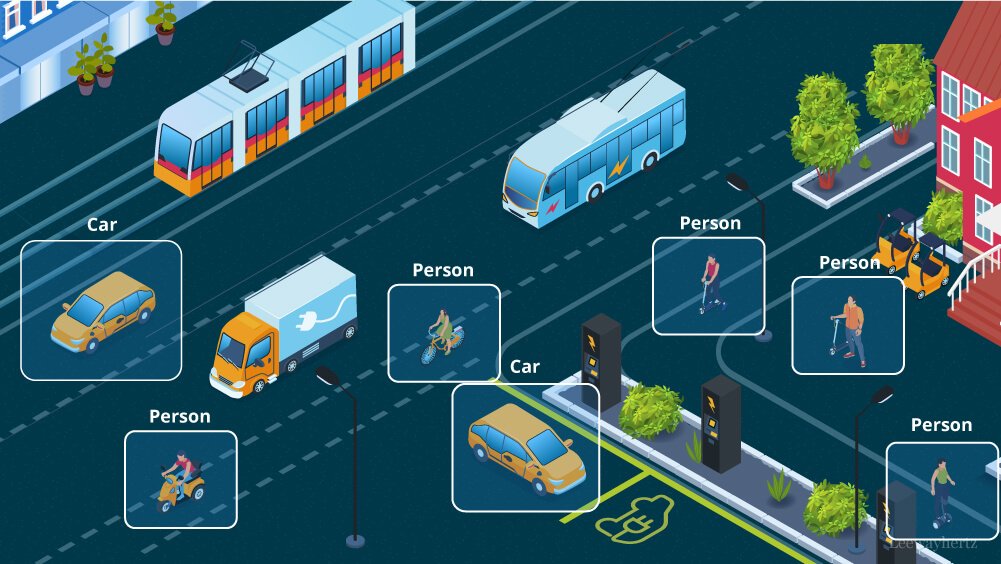
Geospatial data annotation is the process of labeling satellite or aerial imagery with meaningful information. This includes drawing boundaries around buildings, roads, vegetation, water bodies, and more. In machine learning and AI, such labeled datasets are crucial for training computer vision models that can automatically detect and classify geographical features.
For example, if a government agency wants to monitor deforestation in real-time, it needs large volumes of annotated satellite images that show where trees are located and where they are being removed. Similarly, in disaster management, accurately labeled imagery helps responders assess damage and coordinate recovery efforts more effectively.
Without annotation, satellite imagery is just a collection of pixels. Kawnix turns those pixels into precision-ready data.
What Sets Kawnix Apart
Kawnix differentiates itself by offering a streamlined annotation workflow that combines AI-powered automation with human accuracy. Unlike traditional tools that require heavy manual input or technical expertise, Kawnix enables users to access, annotate, and analyze satellite data through a clean and accessible interface.
Some key advantages of the Kawnix platform include:
- Automated Label Suggestions
Kawnix uses artificial intelligence to assist with labeling by suggesting boundaries, objects, or features based on previous annotations. This drastically reduces the time required to annotate large datasets. - Support for Various Annotation Types
Users can apply bounding boxes, polygons, segmentation masks, and classification tags. This flexibility ensures compatibility with different project requirements and machine learning models. - Cloudless Satellite Imagery Access
Kawnix provides clean, cloud-free imagery updated every five days. This ensures that annotations are based on clear, current data, improving both accuracy and relevance. - User-Friendly Interface
No need to install complex software. Kawnix runs in the browser and simplifies access to spatial datasets through natural language queries. Users can type something as simple as “California floods March 2023” and receive the relevant scenes instantly. - Seamless Workflow Integration
Kawnix allows teams to collaborate and annotate images across departments, whether they are in research, government, logistics, or environmental monitoring.
Real-World Applications of Kawnix
The benefits of geospatial data annotation powered by Kawnix extend across multiple industries. Here are a few examples:
- Agriculture
Farmers and agricultural consultants use satellite imagery to track crop health, irrigation coverage, and soil conditions. Kawnix enables the annotation of specific fields or problem zones for targeted analysis and machine learning applications. - Urban Planning
City planners use annotated geospatial data to map road networks, buildings, and public infrastructure. Kawnix helps generate clean datasets to model traffic flow, construction impact, and zoning decisions. - Environmental Protection
Nonprofits and government agencies rely on accurate land-use mapping to monitor ecosystems and prevent illegal logging or mining. Kawnix provides tools to label and monitor protected areas from space. - Disaster Management
In the aftermath of hurricanes, floods, or wildfires, responders use annotated imagery to understand the scale of damage and deploy resources effectively. Kawnix simplifies the process of comparing before-and-after images with AI-assisted tools.
Why AI-Assisted Annotation is the Future
Manual data annotation can be slow, repetitive, and costly. Kawnix solves this problem by integrating artificial intelligence that learns from user input and accelerates future annotations. This active learning loop ensures that human expertise is enhanced, not replaced. As more users contribute annotations, the platform becomes smarter and more efficient.
Moreover, as AI adoption continues to grow across industries, the need for high-quality training data will only increase. Kawnix provides not just the tools to annotate but also the infrastructure to manage, store, and deliver annotated data at scale.
The Kawnix Vision
At its core, Kawnix is building more than a tool. It is building a bridge between raw spatial data and actionable intelligence. The goal is to democratize access to satellite imagery, reduce technical barriers, and accelerate innovation across sectors that depend on geospatial data.
Whether you are a researcher, a business analyst, or a government planner, Kawnix offers a reliable and scalable solution for managing geospatial data workflows. By turning complex satellite data into usable annotated insights, Kawnix empowers you to make informed, data-backed decisions with confidence.
Conclusion
Kawnix is redefining how the world interacts with satellite imagery. With its focus on AI-powered annotation, real-time access, and ease of use, it is becoming an essential platform for any organization working with geospatial data. As the need for smarter Earth observation grows, Kawnix stands ready to deliver clarity, accuracy, and insight from every pixel in space.


